


Tsum valley and Manaslu Circuit Trek
22 Days
Strenous
5110m
Spring (March- May) and Autumn ( Sep-Oct)
Manaslu Region
5-7 hours per day
Tsum Valley and Manaslu – The Hidden Himalayan Journey
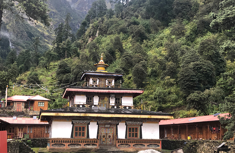
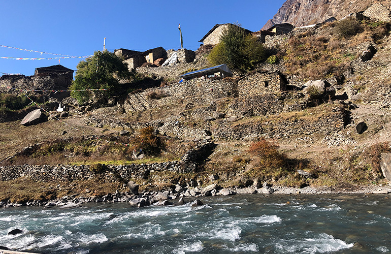
Tsum Valley is a remote and beautiful Himalayan valley known for its Tibetan Buddhist culture, ancient monasteries, traditional villages, and spectacular mountain scenery. Surrounded by the Sringi, Ganesh, and Buddha Himal ranges, the valley is filled with chortens, mani walls, and centuries-old traditions.
Traditionally regarded as a Beyul, or sacred hidden valley, Tsum is believed to be a place of peace, refuge, and happiness. The valley was opened to international visitors in 2008, helping preserve its unique culture and traditional way of life.
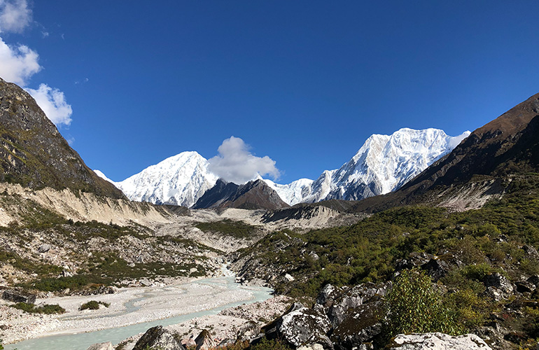
The Manaslu region is one of Nepal’s most spectacular and culturally rich trekking destinations. At its heart stands Mount Manaslu (8,163m), the world’s eighth-highest mountain. The Manaslu Circuit follows the Budhi Gandaki River through deep gorges, waterfalls, forests, traditional villages, and high alpine landscapes.
As the trail rises, trekkers experience changing landscapes and cultures, from lower Himalayan villages to the Tibetan-influenced communities of Nubri and Tsum. Ancient monasteries, prayer flags, chortens, and mani walls are found throughout the region, reflecting the deep Buddhist traditions of the local people.
A major highlight of the Manaslu Circuit is crossing Larkya La Pass (5,106m), one of Nepal’s most impressive high mountain passes. From the pass, trekkers enjoy breathtaking views of Manaslu, Himlung Himal, Cheo Himal, Annapurna II, and surrounding peaks.
Combining the Tsum Valley with the Manaslu Circuit creates a remarkable journey of adventure and cultural discovery. Trekkers experience remote Himalayan landscapes, traditional villages, Buddhist heritage, warm local hospitality, and some of the finest mountain scenery in Nepal—all in one unforgettable journey.
Day 01 : Arrive Kathmandu & Transfer to Hotel
We will pick up you from the airport and lead you to the booked hotel. We will share information about the trip and after that, it is your own day and can enjoy your time followed by welcome dinner.
Day 02 : Preparation and sight seen program of Kathmandu
After breakfast, you will be taken for Kathmandu sight seen program, which includes the visit of Swayambhu temple, Hanuman Dhoka Palace, Patan Durbar Square and Bhaktapur Durbar Square.
Day 03 : Kathmandu to Maccha Khola
Distance: 165 km
Duration: 7 hours
The adventure begins with a scenic drive from Kathmandu toward Machha Khola. The route passes through beautiful hills, rivers, traditional settlements, and rural landscapes. Following the Budhi Gandaki River, you eventually reach Machha Khola, where you spend the night before beginning the trek.
Day 04 : Machhakhola - Jagat (1340m)
Distance: 22 km
Duration: 7 hours
Now, the trail from Machha Khola starts to move up and down and crossing the river- Tharo Khola, we will reach Khorlabesi. If we follow the trail of more ups and downs, then we will reach hot spring called Tatopani. Again, we have to climb over another ridge and then cross Budhi Gandaki on a suspension bridge. Then there comes staircase, across a landslide and over a ridge to Dobhan. After we cross on a suspension bridge on Dobhan Khola and we climb up along the trail to Duman. Now another place will come called Yaru Khola and to reach there, we have to ascend to Budhi Gandaki. There is a suspention bridge over Yaru Khola and after crossing over it, we will have to climb more to reach Tharo Bharyang. Crossing to the west bank of Budi Gandaki and then trekking more lead us to the place called Jagat, office of Manaslu Conservation Area Project (MCAP) and police check post.
Day 05 : Jagat- Lokpa (2240m)
Distance: 18 km
Duration: 7 hours
We will be at Salleri within 30 minute we leave Jagat from where we can the range of Shringi Himal. We will be crossing long bridge and ascend Philim, which is a major village of Tsum valley located on a small plateau. It has a check post of Manaslu Conservation Area Project, a school funded by Japan, community health post and small hydro plant. We will find farmland, which looks beautiful and it is ahead of Philim and then we trek a village called Ekle Bhatti. Now, the valley becomes narrow and scene of waterfall is juts excellent. Then, we will follow the trail for about two and half hours to cross a bridge made of metal over Budhi Gandaki. If we take left turn of the trail, we will be doing Manaslu circuit, but we will take right to catch the trail, which will take us to Tsum valley towards narrow valley of Syar Khola. We will be surrounded by beautiful landscapes when we are at the top of Lokpa and we can also see nice view of beautiful mountain- Ganesh Himal.
Day 06 : Lokpa- Chumling(2380m)
Distance: 11 km
Duration: 5 hours
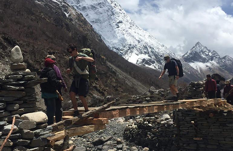
The trekking trail from Lokpa to Chumling is challenging and tough. It goes up and down through a dense forest. We will have to follow the path along Shia Khola before we climb up and down in a dense forest of pine trees. We will go down slowly to the rives, walking over the cantilevered metal bridge fixed at a cliff face. Tsum valley was remained completely isolated for few months in 2016 after the river sliced down this section. There is a suspension bridge fixed over Syar Khola, which we have to cross to reach Chumlin. It is one of the Buddhist village of this region with old monastery, traditional houses, stone paved streets and mani walls. It also has one school, a small clinic, prayer flag and this villages gives immense feelings of Buddhism culture and tradition.
Day 07 : Chumling Chokhangparo (3030)
Distance: 10 km
Duration: Approximate 6 hours
Our next destination is Chokangparo and it is five hours trekking from Chumling. On the trekking, we will have the refreshing view of Lumbo peak, Himal Chuli, Ganesh Himal I, II and IV. Going through the dense forest of pine tree, the trek is quite difficult because of the long, unrelenting uphill to Chopangparo. Walk past Rainjam to Serpu Khola crossing another bridge we arrive at the Gho Village. Crossing over the bridge o Serpu Khola, we arrive at Gho village. We have walk another 2 hours to climb Tsum and we will be at the village named Chhokangparo. If the weather is good, then we can have fantastic view of Himalchuli and Ganesh Himal. We will spend our night at Chhokangparo.
Day 08 : Chhokangparo- Nyile (3500)
Distance: 12 km
Duration: Approximate 5 hours
Today we will reach Ngaku Leru, which is a village of farm with wheat, buckwheat, mustard, potatoes etc. The trail is very easy with mild walk through gombas, chortens and mani walls, We will visit Rachhen Gumba later, therefore, we move towards Lamagaon. On the way to Lamagaon, we will find monastery and beautiful view of landscapes. Other options available with us to visit are Burji village, Milereppa ( Piren Phu) and Chi Phu Gompa. Then, there comes a suspension bridge, which we will cross and going the next side of Syar Khola, we will be at Phurwa and Pangdun Monastery. Now, we are entering another major village called Chule. We can visit Gonhgye Gomba at Chule and have lot of information about Buddhism. If we walk further, then we can see long mani walls with craving of Milereppa. If the weather supports us, then we can see the fabulous view of sunset over the mountain and village.
Day 09 : Nyile - Mu Gumba(3700m) - Lamagaun(3300m)
Distance: 12 km
Duration: Approximate 4/5 hours
After doing breakfast at Nile, we will move towards Mu Gompa. It will take two hours to get there from Nile and is the last village of Tsum valley located above Syar Khola. While exploring the monastery, we will have opportunity to learn about Buddhism through religious books. The statues of Avalokiteshwara, Guru Padmasambhava and Tara will refresh us and we will forget our tiredness. The scenery of Longnang glacier and pasture of yak cannot be described in words. Another historic monastery we can visit is Dhephu Doma Gompa, which is considered 600 years old. It has safely preserved ancient thankas. From Mu Gumpa, the view of Ganesh Himal is excellent. We will get back to Lamagaun.
Day 10 : Lamagaun - Chumling (2380)
Distance: 13 km
Duration: Approximate 5 hours
Descend through the beautiful forests and mountain trails towards Chumling. The route provides a chance to revisit the villages and landscapes of lower Tsum Valley. Enjoy the peaceful surroundings and traditional Tsumba culture..
Day 11 : Chumling to Deng (1860m)
Distance: 18 km
Duration: 7-8 hours
Today you leave Tsum Valley and reconnect with the main Manaslu Circuit trail. The route passes through forests and along the Budhi Gandaki River, crossing suspension bridges and passing traditional settlements. Continue towards Deng, a small village surrounded by dramatic mountain scenery.
Day 12 : Deng - Namrung (2630m):
Distance: Approximate 14.5 km
Duration- 5-6 hours
With the refreshing view of Kuntang Himal, we will leave Bihi village in the early morning after breakfast to reach Bihi village. We will see many manis built by the local people of Bihi village indicating their great passion towards Buddhism. There is also a monastery popularly called Serang Gompa at the foothills of Sringi Himal. It is considered as one of the major meditation site of Guru Ronpochhe. We will cross Serang Khola following a trail, which continues high above Budi Gandaki river.
After walking for two and half hour with the spectacular scenery, we will walk on the bridge to cross Budi Gandaki and we will be in Ghap. After we leave Ghap, we have to climb and walk through another dense forest of rhododendron, bamboo and oaks. Then, there comes a suspension bridge, which we have to cross built over Budhi Gandaki river. On the trail, we can see the national bird of Nepal- Lophophorus in the forest. Finally, we will arrive our destination for today- Namrung. This is the first village of Nubri and most of the people speak Tibetan language and follow Buddhism. Locally, Nubri means western ridge or western mountains.
Day 13 : Namrung - Shyala (3500m)
Distance: Approximate 14 km
Duration: 5-6 hours
From Namrung, we have to trek through barley field and pasture to get another human settlement i.e. Banjam. Now our climbing starts steep and we will get to Lihi ( 2920m). During the trekking, we can have the splendid view of mountains- Ngadi Himal and Manaslu.north. Then, we will enter another beautiful village, which is locally called Sho.
Our walking through the field of buckwheat, wheat and barley continues with the beautiful view of Ngadi Chuli. After descending from Sho and crossing a small river, we will reach Shrip, where we can find the local women busy in weaving. We will now take a short but steep ascent to reach Lho village. In this village also, we can see local women working on the looms. This village has Nyingma Rimjug Gompa, where more than 100 monks stay and study. We can just wander and explore around this village to have look on chorten, prayer flag and mani representing the practice of Buddhism culture and religion. At out backdrop, the spectacular view of Manaslu can be seen.
Our trekking continues on the barley fields, descending and crossing a small river on wooden bridges. Then, we start ascending through forest crossing a small hydroelectric project and our hiking will keep on until we reach Hong Sangbu Gompa. It is at the seasonal herding spot called Musitang Kharka and is surrounded by mountains. Our next destination is Shyala, where we will spend our night. To reach this place, we have to climb down and experience the local women working in an old mill roasting barley to convert into tsampa. It is the place of summer settlement with new lodges and old houses from where excellent view of mountain panoramas can be seen.
Day 14 : Shyala - Sama Gaon (3520m)
Distance: Approximate 12 km
Duration: 5-6 hours
While going from Shyala to Sama Gaon, we see a stream made from Pung Ghyen glacier and it has to be crossed to ascend next to the small river. Now, we can visit Pung Gyen Monastery and its backdrop becomes fascinating because of Mt. Manaslu. Carefulness is needed from our side while walking on icy and slippery path through Numla Khola and debris f Pung Ghyen glacier. While we look down the village from this place, we can see excellent view of glacial lake and Mt. Manaslu. One important fact we should know about Pung Gyen Monastery that it was destroyed by avalanche in 1953. The current state of the monastery was restored one. In the area of this monastery, we can find a cave gompa from where we can more better panorama of the valley. After spending some time at this place, our return journey to Mansalu starts and trek to Sama gaon to spend our night. It is a bigger village of Manaslu circuit located at the base of Mt. Manaslu.
Most of the people living in this place are of Tibet origin and their religion is Buddhism. While wandering around the village, we can see manis, prayers. and chhortens. These establishments are the indications of the local people of this village showing great passion towards Biddhism. The people living in this village grow barley and potatoes for just three months. In the remaining months, they become engaged in trading with lower villages and Tibet. The houses of this village is made of stone, wood and shingles with animal pen underneath their homes.
Day 16 : Acclimatization day at Sama Gauon (Hike to Manaslu Base Camp)
Distance: Approximate 14 km
Duration: 7-8 hours
On this day, we can take rest, but it is better for us to acclimatize to make our further trip easier. Therefore, we can trek to higher altitude and go towards Glaciel Birendra lake. If we have more capacity and interested to explore more, then we can trek up to the base camp of Mt. Manaslu. It can be reached with the walking time of 7-8 hours. It would be better if we start our journey in the early morning so that we can avoid sun burn and have best views of Mt. Manaslu, Birendra Glacier lake and the village. During the expedition season, the base camp of Mt. Manaslu is crowded with mountaineers, sherpas, porters and tents.
As we continue our trip to the base camp of Mt. Manaslu, the mountain landscape becomes more beautiful with the view of Mt. Manaslu, Naike peak and surrounding hills. The highest altitude that we reach on this package is 4800 m, where we feel we are in mountains.
Day 17 : Samagaun - Samdo (3875m)
Distance: Approximate 8km
Duration: 3-4 hours
Today's trekking is very short so we can do comfortably starting from Samagaon. We will cross a bridge and walk west towards Mt. Manaslu base camp and Birendra lake. Going through the forest of past juniper, rhododendron, birch, we will find a lake below us and will move near to the majestic icefall of Manaslu glacier. During our trekking to Samdo, we need to cross a stream moving towards north and will pass by the left side of lengthy mani walls at Kyongma Kharka. Finally, we will be able to locate chortens of Samdo.
We will trek back to Budhi Gandaki and do short climb that will lead us to Samdo after crossing a bridge. This village has a small monastery and it is also the village of people, whose ancestors from Tibet following Buddhism culture and they are found in the farm looking after sheep, yaks, goats, horses.
Day 18 : Samdo - Larkya Phedi/ Dharamsala (4480 m)
Distance: Approximate 6 km
Duration: 3-4 hours
Today is also short day trekking of 3-4 hours walking from Samdo to Larkya Phedi. Crossing a small bridge and heading towards west above the Larkya Bazaar, then we will go through field and walk on grassy plateaus of short juniper bushes and rhododendron. The scene of landscape become more beautiful as we move ahead. On the side of the valley, we can have magnificent view of glacier, which comes from Manaslu and Manslu north peaks. Then finally, we will be at the high camp of Larkya La pass called Dharamsala.
We can see blue sheep in the barren slopes and the temperature of this place is very cold, therefore, we need to keep ourselves warm in the afternoon. If we are strong and want to wander more, then we can climb more on the ridges of Samdo valley to enjoy the birds flying and blue sheep. At the south side of us, the view of Naike Peak is just fantastic and in front of us, we can see the summit point of Mt. Manaslu.
Day 19 : Cross Larkya La (5160m) - Bimthang (3590m)
Approximate distance: 16 km
Duration: 8-9 hours
We have to trek longer today, hence, we need to get ready early in the morning for the breakfast. Initial trek of about 30 minutes is little bit easy. Then, we will trek along the right side of debris of Larkya glacier and then through the narrow bottom of the valley. We will arrive the valley, which is at the north side of Larkya glacier. From this place, the view of Ganesh Hima I (at the east side) and Larkya peak (at the west side) can be beautifully seen. We will continue our trek on glacial debris and most of the time, it is snowy. After two hours of walking, we will be at the small hut located at an altitude of 4920m.
If we walk two and hours from here, then we will be at the top of Larkye pass. It has small ridges, frozen lake and last portion of the summit is steeper. From the top, we can see Samdo peak and other border peak of Tibet and Nepal. On the west side of Larkye pass, other mountains like Annapurna II, Kang Guru, Himlung and Cheo Himal can be seen very clearly. It is also very windy place and then climbing high through razor edge ridge followed by a sharp drop. Carefulness is needed very much on this trail since it is slippery and icy. We will walk on the trail that takes us to the left side of Salpu Danda glacier debris. We will locate a comfortable place to have our packed lunch and then descend steeply.
During this walking down, we can see pastures with short rhododendron, primulas and azalea. It will be our about three hour difficult descending walk to reach Bimthang. If luck is in our favour, then we can get opportunity to encounter with blue sheep, pika, marmot and Tibetan snow-cock track with the high chance to see snow leopard.
Day 20 : Bimthang – Dharapani ( 1965m)
Approximate distance: 24 km
Duration: 7-8 hours
Today is the day of descending, which starts from Burdin Khola to the highest cultivating area in the village called Karche. Then we again move downward to Gho followed by the trek to Tilje. We will then Dudh Khola on a wooden bridge and arrive at Dharapani.
Day 21 : Dharapani – Kathmandu
10-11 hours Drive
After breakfast, begin the long drive from Dharapani towards Besisahar. From Besisahar, continue by road towards Kathmandu. The journey passes through hills, rivers, terraced farmland, and numerous villages. Arrive in Kathmandu in the evening, marking the end of your Tsum Valley and Manaslu Circuit adventure.
Day 22 : Departure
Have a safe journey
Inclusion
- All airport/hotel transfers
- Accommodation in a 3-star hotel (Hotel Moonlight) in Kathmandu with breakfast
- Guesthouse accommodation during trekking in the mountains
- Breakfast in Kathmandu and all meals during trek
- All ground transportation as per the itinerary by private vehicles
- All necessary staff with experienced leader (guide), assistant guide (4 trekkers: 1 assistant guide) and Sherpa porters to carry luggage (2 trekkers:1 porter) including their salary, insurance, equipment, flight, food and lodging
- All necessary paper works; trekking permits (ACAP, special permit for Manaslu)
- Welcome dinner
- Exclusive Medical Kit Bag
- All government and local taxes
Exclusion
- Nepalese visa fee
- International airfare to and from Kathmandu
- Excess baggage charges
- Lunch and dinner in Kathmandu
- Extra night accommodation in Kathmandu in case of early arrival, late departure, and early return from the mountain (due to any reason) than the scheduled itinerary
- Travel and rescue insurance(Should be covered helicopter evacuation incase of problem on the trek and medical also)
- Personal expenses (phone calls, laundry, bar bills, battery recharge, extra porters, bottle or boiled water, shower, etc.)
- Tips for guide(s), porter(s) and driver(s)
Note
We shall not be responsible for any changes and alterations in the itineraries due to unavoidable circumstances i.e. landslide, road blockage, floods, snowfall, political unrest, cancellation of flights, delay arrivals, sickness or accidents and any extra cost incurring there of shall be borne by the clients themselves at the spot. It is most advisable for clients to have full INSURANCE against medical evacaution and personal accidents.